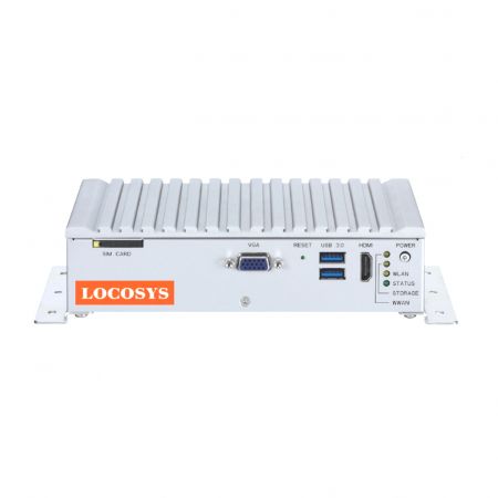
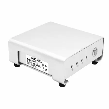
RTK System
RTK Base Station
Introduction to Locosys RTK Base Station Equipment
In today's rapidly developing era of precise positioning technology, LOCOSYS has leveraged its advanced RTK (Real-Time Kinematic) base station equipment to provide high-precision positioning solutions for various industries. Whether in agriculture, construction, surveying, or autonomous driving, LOCOSYS's RTK base station equipment meets users' demands for accuracy and reliability.
High-Precision Positioning
LOCOSYS's RTK base station equipment offers superior positioning accuracy, achieving centimeter-level precision. The core of this technology lies in its unique differential positioning algorithm, which can instantly process data from multiple satellites and send correction information to mobile devices via the base station, significantly enhancing positioning accuracy. This is an indispensable tool for applications requiring precise data, such as topographic surveys and precision agriculture.
L1+L2+L5 Multi-Frequency Satellite System Functionality
LOCOSYS's RTK base station equipment supports L1, L2, and L5 frequency bands, making it compatible with various satellite systems (such as GPS, GLONASS, BeiDou, and Galileo). This multi-frequency satellite system capability allows the equipment to acquire more satellite signals in complex environments, further improving positioning accuracy and stability. In particular, the L5 frequency band offers higher signal strength and anti-interference capabilities, enabling reliable performance even in challenging conditions.
Stable Signal Transmission
LOCOSYS RTK base station equipment employs advanced wireless communication technology to ensure stable signal transmission. Whether in urban environments with tall buildings or open agricultural fields, the equipment maintains a stable connection, minimizing the risk of signal interruption. Additionally, the design of the base station considers various climatic conditions, providing excellent anti-interference capabilities to ensure normal operation even in harsh weather.
Easy Installation and Operation
LOCOSYS's RTK base station equipment not only boasts outstanding performance but also features easy installation and operation. Users can complete the setup with simple steps and operate the device through an intuitive interface without requiring a professional technical background. Furthermore, LOCOSYS provides detailed user manuals and technical support to ensure users can quickly get started and fully utilize the equipment's capabilities.
RTK Base Station Specifications and Features
1. Positioning Accuracy: Centimeter-level accuracy, supporting multiple satellite systems
(GPS, GLONASS, BeiDou, Galileo, QZSS).
2. Frequency Range: Supports multi-frequency signals, enhancing anti-interference
capabilities and improving positioning stability.
3. Communication Interfaces: Equipped with various communication interfaces, including
4G-LTE/5G, RS232, USB, Ethernet, and Bluetooth, facilitating connections with other devices.
4. Power Supply: Supports multiple power supply options, including battery and external
power, to adapt to different working environments.
5. Operating Temperature: Wide operating temperature range to withstand extreme climatic
conditions, ensuring long-term stable operation.
6. FireBird RTK Testing Software: Supports multiple operating systems (include Win10/11、
Android), allowing users to process data according to their needs.
Diverse Application Scenarios
The application range of Locosys RTK base station equipment is extensive. Whether it is for autonomous driving agricultural machinery, precision measurement on construction sites, or data collection for Geographic Information Systems (GIS), this equipment provides reliable support. As technology advances, Locosys continuously develops new technologies, striving to innovate in the field of precise positioning and deliver greater value to customers.
Conclusion
In summary, LOCOSYS's RTK base station equipment, with its exceptional performance and stability, has become an ideal choice for precise positioning across various industries. Whether you are an agricultural expert, construction engineer, or surveying professional, LOCOSYS can provide you with the highest quality positioning solutions. Choose LOCOSYS, and let precise positioning become your competitive advantage!
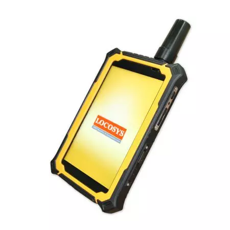
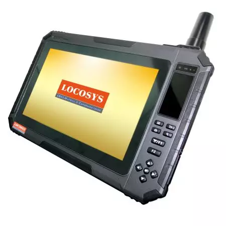
Suitable for the following GNSS Series Product
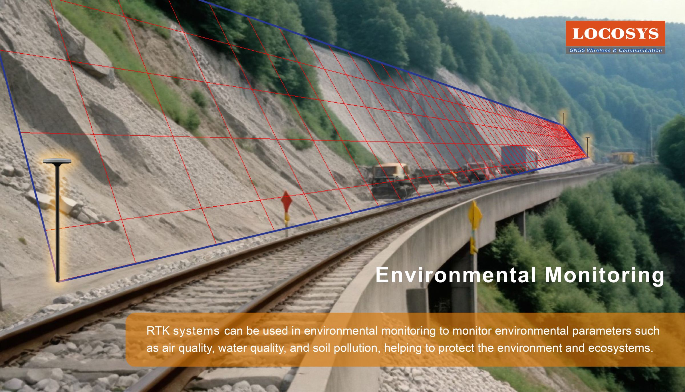
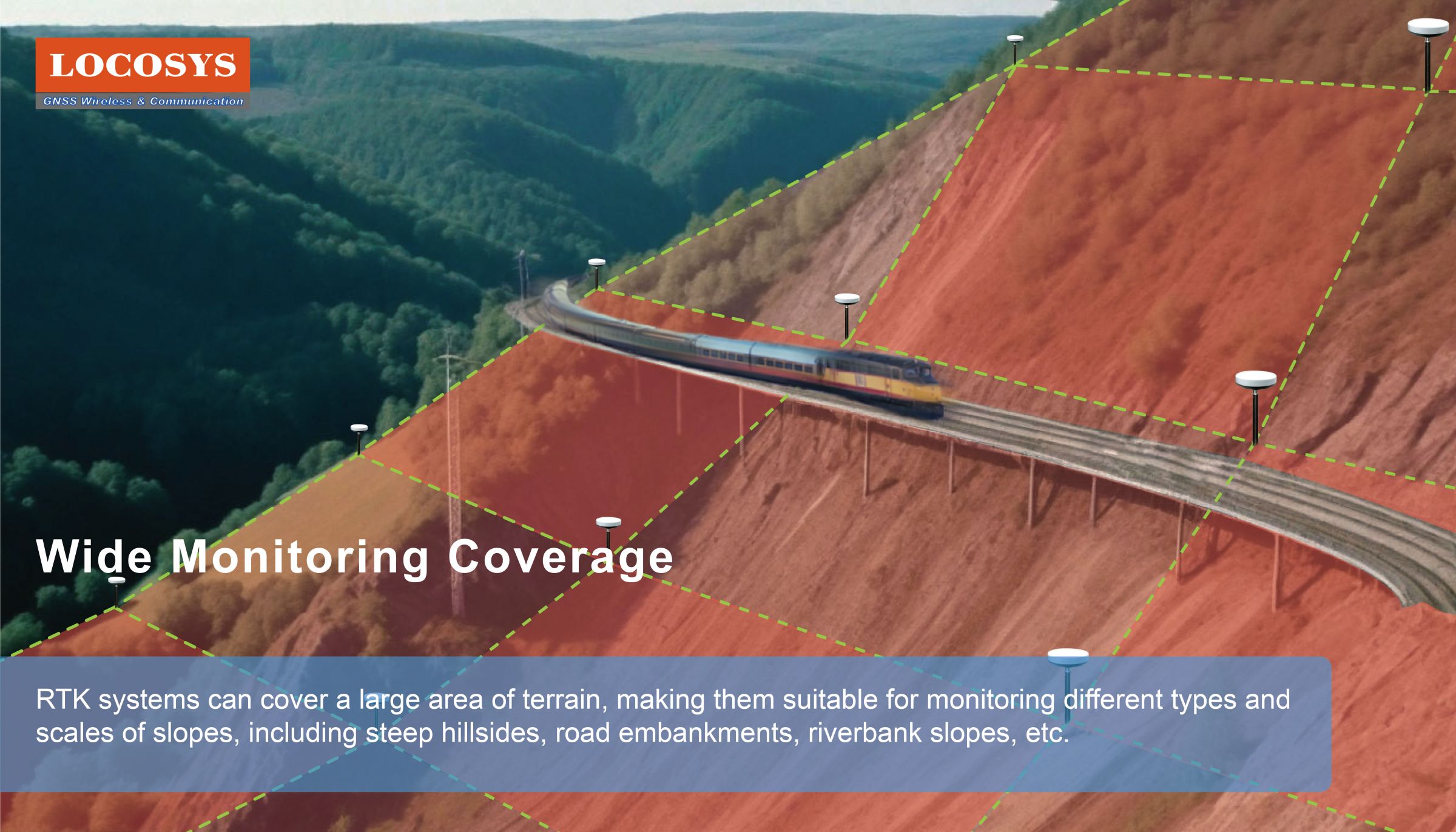
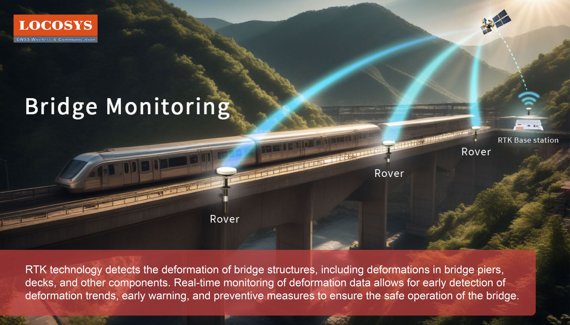
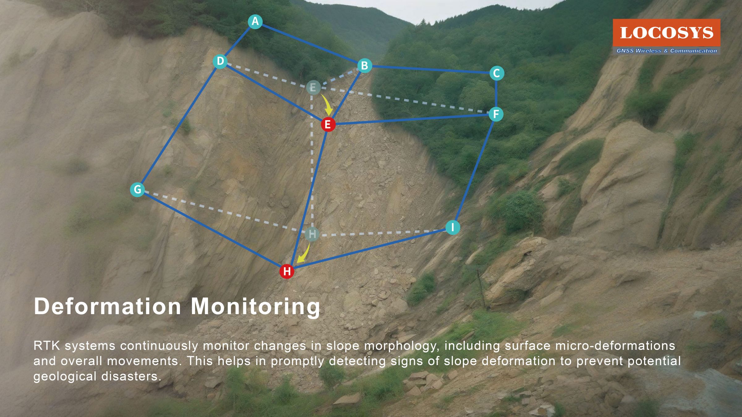
RTK plays a crucial role in slope monitoring. Through RTK technology, real-time monitoring of terrain changes is possible, providing high-precision position information to help detect and prevent geological hazards such as landslides and deformations. Here are some key roles of RTK in slope monitoring:
Environmental Monitoring / Wide Monitoring Coverage / Bridge Monitoring / Deformation Monitoring /
Alerts and Warnigs
Global earthquakes happen frequently during these years, especially at the junction between different Plates. Just in 2020, the number of global earthquakes almost achieves 350,000. Even if for Asia itself, which locates among Eurasian Plate, Indian Plate, Arabian Plate, and Philippine Plate, the number of its earthquake also achieves 65,000 in 2020.
Therefore, in order to avoid any possible accidents and completely solve the Landslide Displacement caused by earthquakes, soil liquefaction, or any other reasons, the fulfilling requests of the Real-Time Monitoring and Early Warning with Accurate Analysis via our RTK products has been arising currently. It can be used for different application (such as slope, bridges, tunnels, dam, river courses, building facilities, construction vehicle inspection, and others).
When using RTK application, Base Station and Rover are necessary settings. The concept of the application is like the example of the above picture and video. Our RTK product, such as RTK-M300, can be set up as the Base Station and be located on the roof of railway platform. The Rovers can be located at the different spots of a mountain, by a river, or at the both side of rail road. Once any of the rovers slightly moves (shown in the video), the location signals would be instantly forwarded to your computer (i.e. your system) with sound alerts soon. Meanwhile, the moved rovers would also be displayed as “Red Location Marker” also on your computer screen as a reminder.
Press Release
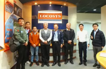 Taiwan Excellence Drone Alliance Visits LOCOSYS Technology, Focusing On Global Positioning Technology And Drone Applications
The Taiwan Excellence Drone Overseas Business Alliance, led by Yen Tung-Piao,visited a leading smart manufacturing enterprise with a delegation includingrepresentatives from AIDC, the Industrial...
Read More LOCOSYS Showcases Advanced Smart Positioning Technology At New Taipei Electric Vehicle Supply Chain Expo
To promote the development of Taiwan's electric vehicle (EV) industry and enhance international collaboration, the New Taipei City Government hosted the Electric Vehicle Supply Chain Expo...
Read More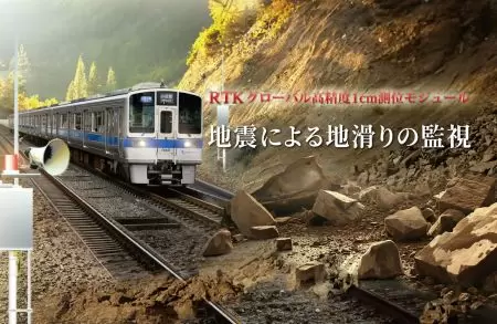 LOCOSYS Technology Unveils New High-Performance SONY GNSS/RTK Global Satellite Positioning Modules
LOCOSYS will showcase its advanced RTK solutions and high-performance GNSS modules, including those powered by Sony’s latest GPS technology, at the 2024 Sensor Expo in Tokyo. These modules,...
Read More