-

-

-

-
-

-

-
-
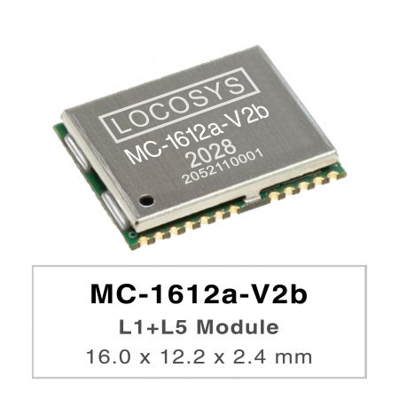
MC-1612a-V2b
MC-1612a-V2b
LOCOSYS MC-1612a-Vxx is a high-performance dual-band GNSS positioning module that is capable of tracking all global civil navigation systems. It adopts 12 nm process and integrates efficient power management architecture to perform low power and high sensitivity. Besides, concurrent reception of L1 and L5 band signals mitigates the multipath delay and achieves more accurate position. The module supports hybrid ephemeris prediction to achieve faster cold start. One is self-generated ephemeris prediction (called EPOC) that is no need of both network assistance and host CPU’s intervention. This is valid for up to 3 days and updates automatically from time to time when GNSS module is powered on and satellites are available. The other is server-generated ephemeris prediction (called EPO) that gets from an internet server. This is valid for up to 14 days. Both ephemeris predictions are stored in the on-board flash memory and perform a faster cold start. The RF front end of MC-161a-V3b the module is specifically designed to comply with sensitivity specification contained in AIS 140 standard. It is the best solution to those customers that design tracking applications in compliance with AIS 140.
-
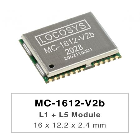
MC-1612-V2b
MC-1612-V2b
LOCOSYS MC-1612-Vxx series are high-performance dual-band GNSS positioning modules that are capable of tracking all global civil navigation systems. They adopt 12 nm process and integrate efficient power management architecture to perform low power and high sensitivity. Besides, concurrent reception of L1 and L5 band signals mitigates the multipath delay and achieves sub-meter position accuracy. The modules support hybrid ephemeris prediction to achieve faster cold start. One is self-generated ephemeris prediction (called EPOC) that is no need of both network assistance and host CPU’s intervention. This is valid for up to 3 days and updates automatically from time to time when GNSS module is powered on and satellites are available. The other is server-generated ephemeris prediction (called EPO) that gets from an internet server. This is valid for up to 14 days. Both ephemeris predictions are stored in the on-board flash memory and perform a cold start time less than 15 seconds The RF front end of MC-1612-V3b the module is specifically designed to comply with sensitivity specification contained in AIS 140 standard. It is the best solution to those customers that design tracking applications in compliance with AIS 140.
-
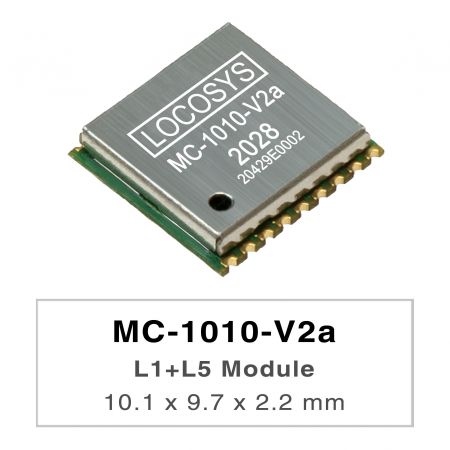
MC-1010-V2a
MC-1010-V2a
LOCOSYS MC-1010-Vxx series are high-performance dual-band GNSS positioning modules that are capable of tracking all global civil navigation systems. They adopt 12 nm process and integrate efficient power management architecture to perform low power and high sensitivity. Besides, concurrent reception of L1 and L5 band signals mitigates the multipath delay and achieves sub-meter position accuracy. The modules support hybrid ephemeris prediction to achieve faster cold start. One is self-generated ephemeris prediction (called EPOC) that is no need of both network assistance and host CPU’s intervention. This is valid for up to 3 days and updates automatically from time to time when GNSS module is powered on and satellites are available. The other is server-generated ephemeris prediction (called EPO) that gets from an internet server. This is valid for up to 14 days. Both ephemeris predictions are stored in the on-board flash memory and perform a cold start time less than 15 seconds. MC-1010-V3x with the active antenna can comply with the sensitivity specification contained in AIS 140 standard. It is the best solution to those customers that design tracking applications in compliance with AIS 140.
-
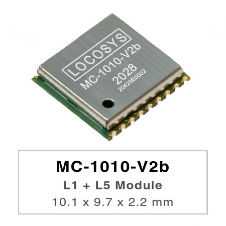
MC-1010-V2b
MC-1010-V2b
LOCOSYS MC-1010-Vxx series are high-performance dual-band GNSS positioning modules that are capable of tracking all global civil navigation systems. They adopt 12 nm process and integrate efficient power management architecture to perform low power and high sensitivity. Besides, concurrent reception of L1 and L5 band signals mitigates the multipath delay and achieves sub-meter position accuracy. The modules support hybrid ephemeris prediction to achieve faster cold start. One is self-generated ephemeris prediction (called EPOC) that is no need of both network assistance and host CPU’s intervention. This is valid for up to 3 days and updates automatically from time to time when GNSS module is powered on and satellites are available. The other is server-generated ephemeris prediction (called EPO) that gets from an internet server. This is valid for up to 14 days. Both ephemeris predictions are stored in the on-board flash memory and perform a cold start time less than 15 seconds. MC-1010-V3x with the active antenna can comply with the sensitivity specification contained in AIS 140 standard. It is the best solution to those customers that design tracking applications in compliance with AIS 140.
-
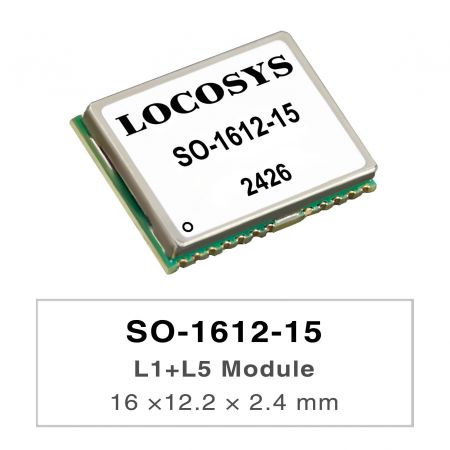
SO-1612-15
SO-1612-15
SO-1612-15 is a dual-band GNSS positioning receiving modules that a capable of tracking all global civil navigation systems (BDS, GPS, GLONASS, Galileo, QZSS, IRNSS and SBAS) in all band bands. Built-in highly integrated GNSS receiving chip supports the third generation Beidou Satellite Navigation System (BDS-3). SO-1612-15 module is based on the state of art BDS-3 architecture, integrating multi-band and multi-system GNSS RF and baseband. This newly designed architecture makes this single chip achieve sub-meter level position accuracy without correction data from ground-based augmentation station and higher sensitivity, greater for improved jam resistance and multipath, provide a highly robust service in complicated environment. SO-1612-15 module contains CXD5610GF positioning engine inside, featuring high sensitivity, low power consumption, and fast TTFF. The superior cold start sensitivity allows it to acquire, track, and get position fix autonomously in difficult weak signal environment. The receiver’s superior tracking sensitivity allows continuous position coverage in nearly all outdoor application environments.
-
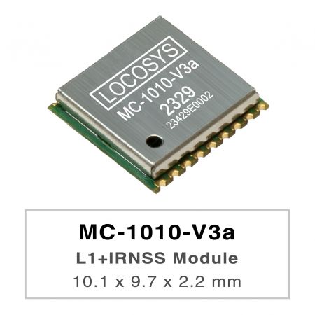
MC-1010-V3a
MC-1010-V3a
LOCOSYS MC-1010-Vxx series are high-performance dual-band GNSS positioning modules that are capable of tracking all global civil navigation systems. They adopt 12 nm process and integrate efficient power management architecture to perform low power and high sensitivity. Besides, concurrent reception of L1 and L5 band signals mitigates the multipath delay and achieves sub-meter position accuracy. The modules support hybrid ephemeris prediction to achieve faster cold start. One is self-generated ephemeris prediction (called EPOC) that is no need of both network assistance and host CPU’s intervention. This is valid for up to 3 days and updates automatically from time to time when GNSS module is powered on and satellites are available. The other is server-generated ephemeris prediction (called EPO) that gets from an internet server. This is valid for up to 14 days. Both ephemeris predictions are stored in the on-board flash memory and perform a cold start time less than 15 seconds. MC-1010-V3x with the active antenna can comply with the sensitivity specification contained in AIS 140 standard. It is the best solution to those customers that design tracking applications in compliance with AIS 140.
-
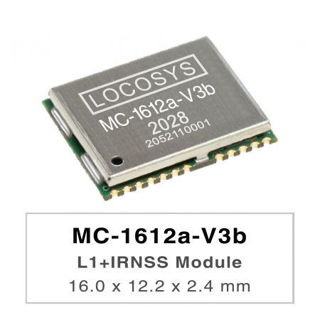
MC-1612a-V3b
MC-1612a-V3b
LOCOSYS MC-1612a-Vxx is a high-performance dual-band GNSS positioning module that is capable of tracking all global civil navigation systems. It adopts 12 nm process and integrates efficient power management architecture to perform low power and high sensitivity. Besides, concurrent reception of L1 and L5 band signals mitigates the multipath delay and achieves more accurate position. The module supports hybrid ephemeris prediction to achieve faster cold start. One is self-generated ephemeris prediction (called EPOC) that is no need of both network assistance and host CPU’s intervention. This is valid for up to 3 days and updates automatically from time to time when GNSS module is powered on and satellites are available. The other is server-generated ephemeris prediction (called EPO) that gets from an internet server. This is valid for up to 14 days. Both ephemeris predictions are stored in the on-board flash memory and perform a faster cold start. The RF front end of MC-161a-V3b the module is specifically designed to comply with sensitivity specification contained in AIS 140 standard. It is the best solution to those customers that design tracking applications in compliance with AIS 140.
-
-
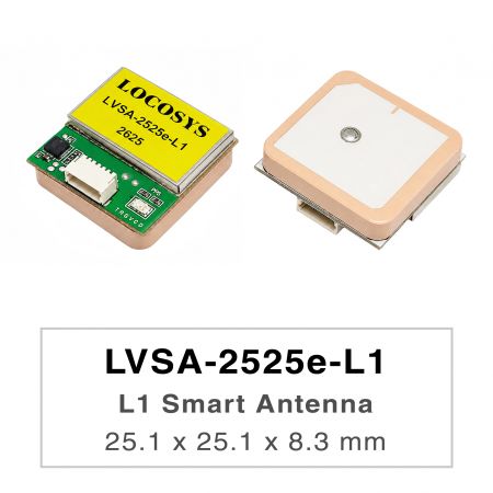
LVSA-2525e-L1
LVSA-2525e-L1
The LVSA-2525e-L1 is a high-performance GNSS smart antenna that integrates a GNSS receiver module with a 25 × 25 × 4 mm ceramic patch antenna in a compact design. It supports single-band, multi-constellation GNSS reception, including GPS, GLONASS, Galileo, BeiDou, QZSS, and SBAS, providing reliable positioning performance for a wide range of navigation applications. Based on an advanced GNSS receiver architecture, the LVSA-2525e-L1 delivers excellent positioning accuracy, high sensitivity, and fast signal acquisition. Its robust tracking capability ensures stable positioning performance even in challenging environments such as urban canyons, under dense foliage, or in areas with weak satellite signals. The LVSA-2525e-L1 features low power consumption and fast Time-To-First-Fix (TTFF), making it suitable for battery-powered and embedded applications. With continuous multi-constellation tracking and advanced interference mitigation technology, the smart antenna provides reliable positioning performance and enhanced resistance to multipath effects, ensuring dependable operation in demanding outdoor environments. The integrated ceramic patch antenna provides optimized satellite signal reception while maintaining excellent positioning performance. Combined with the built-in low-noise amplifier (LNA) and high-performance GNSS receiver, the LVSA-2525e-L1 is an ideal solution for applications such as UAV (Unmanned Aerial Vehicle), Location Based Services (LBS), vehicle navigation systems, and Portable Navigation Devices (PNDs).
-
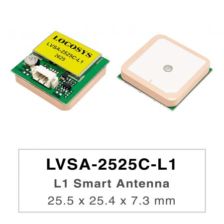
LVSA-2525C-L1
LVSA-2525C-L1
The LVSA-2525C-L1 is a high-performance GNSS smart antenna that integrates a GNSS receiver module with a 25 × 25 × 4 mm ceramic patch antenna in a compact design. It supports single-band, multi-constellation GNSS reception, including GPS, GLONASS, Galileo, BeiDou, QZSS, and SBAS, providing reliable positioning performance for a wide range of navigation applications. Based on an advanced GNSS receiver architecture, the LVSA-2525C-L1 delivers excellent positioning accuracy, high sensitivity, and fast signal acquisition. Its robust tracking capability ensures stable positioning performance even in challenging environments such as urban canyons, under dense foliage, or in areas with weak satellite signals. The LVSA-2525C-L1 features low power consumption and fast Time-To-First-Fix (TTFF), making it suitable for battery-powered and embedded applications. With continuous multi-constellation tracking and advanced interference mitigation technology, the smart antenna provides reliable positioning performance and enhanced resistance to multipath effects, ensuring dependable operation in demanding outdoor environments. The integrated ceramic patch antenna provides optimized satellite signal reception while maintaining excellent positioning performance. Combined with the built-in low-noise amplifier (LNA) and high-performance GNSS receiver, the LVSA-2525C-L1 is an ideal solution for applications such as asset tracking, Location Based Services (LBS), vehicle navigation systems, and Portable Navigation Devices(PNDs).
-
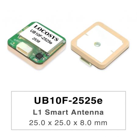
UB10F-2525e
UB10F-2525e
LOCOSYS proudly announces the launch of its latest GNSS module, the UB10F-2525e, powered by state-of-the-art 10th-generation GNSS chipsets. This new product line integrates multi-constellation reception with support for GPS, GLONASS, Galileo, and BeiDou, delivering advanced high-precision positioning with optimized power management. Even in complex environments such as urban canyons or highly obstructed areas, the UB10F-2525e ensures stable and reliable availability. Backed by LOCOSYS’s extensive experience in high-precision positioning and system integration, the company has successfully helped numerous overseas clients achieve unmanned and autonomous positioning projects, making LOCOSYS the trusted partner of choice. Designed to meet the rapidly growing demand for accuracy, it provides robust solutions for UAVs, AGVs/UGVs, robotics, unmanned vessels, e-bikes, and automotive applications. With LOCOSYS’s expertise in design and system integration, the UB10F-2525e offers meter-level accuracy while maintaining outstanding resilience in dynamic environments. The chipset delivers enhanced RF sensitivity under 25×25 mm patch antenna and weak signal conditions, supported by advanced interference and spoofing detection mechanisms that further strengthen system reliability. This product launch once again underscores LOCOSYS’s long-standing commitment to enabling autonomous and unmanned applications, driving industries toward smarter, more connected, and future-ready mobility and positioning ecosystems. By combining cutting-edge GNSS/RTK technology with proven integration know-how, LOCOSYS continues to empower global partners in building reliable, scalable, and innovative solutions for the next generation of intelligent mobility.
-
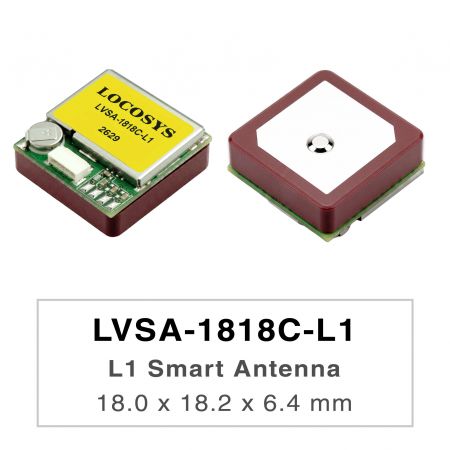
LVSA-1818C-L1
LVSA-1818C-L1
The LVSA-1818C-L1 is a high-performance GNSS smart antenna that integrates a GNSS receiver module with a 18 × 18 × 4 mm ceramic patch antenna in a compact design. It supports single-band, multi-constellation GNSS reception, including GPS, GLONASS, Galileo, BeiDou, QZSS, and SBAS, providing reliable positioning performance for a wide range of navigation applications. Based on an advanced GNSS receiver architecture, the LVSA-1818C-L1 delivers excellent positioning accuracy, high sensitivity, and fast signal acquisition. Its robust tracking capability ensures stable positioning performance even in challenging environments such as urban canyons, under dense foliage, or in areas with weak satellite signals. The LVSA-1818C-L1 features low power consumption and fast Time-To-First-Fix (TTFF), making it suitable for battery-powered and embedded applications. With continuous multi-constellation tracking and advanced interference mitigation technology, the smart antenna provides reliable positioning performance and enhanced resistance to multipath effects, ensuring dependable operation in demanding outdoor environments. The integrated ceramic patch antenna provides optimized satellite signal reception while maintaining excellent positioning performance. Combined with the built-in low-noise amplifier (LNA) and high-performance GNSS receiver, the LVSA-1818C-L1 is an ideal solution for applications such as asset tracking, Location Based Services (LBS), vehicle navigation systems, and Portable Navigation Devices (PNDs).
-
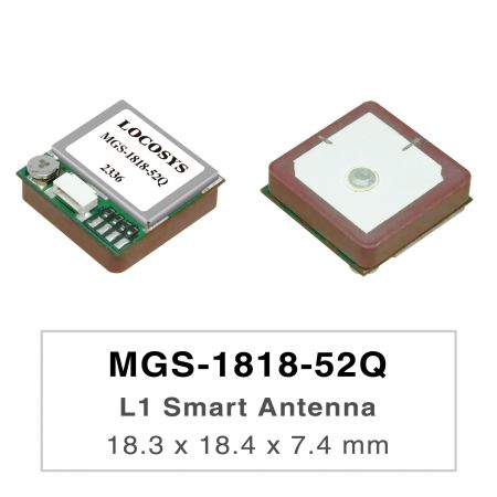
MGS-1818-52Q
MGS-1818-52Q
MGS-1818-52Q is a complete standalone multi-frequency GNSS smart antenna module, including embedded patch antenna and GNSS receiver circuits which is based Airoha AG3352Q platform. The module can simultaneously acquire and track multiple satellite constellations that include GPS, GLONASS, GALILEO, BAIDOU, and QZSS simultaneously, which in combination with the support of SBAS, greatly increases the number of visible satellites and enhances positioning accuracy. Its superior cold-start sensitivity allows it to acquire, track, and get position fix autonomously in difficult weak signal environment. Its superior tracking sensitivity allows continuous position coverage in nearly all outdoor application environments. The module supports hybrid ephemeris prediction to achieve faster cold start. One is self-generated ephemeris prediction (called EASY) that is no need of both network assistance and host CPU’s intervention. This is valid for up to 3 days and updates automatically from time to time when GNSS module is powered on and satellites are available. The other is server-generated ephemeris prediction (called EPO) that gets from an internet server. This is valid for up to 14 days. Both ephemeris predictions are stored in the on-board flash memory and perform a cold start time less than 15 seconds. The faster GNSS fixes make it possible to use accurate positioning and navigation services anytime and anywhere with a smaller power budget than previously possible. Available in a cost-optimized version as well as a low-power version which supports for the Adaptive Low Power (ALP) feature in fitness and normal navigation modes.
-
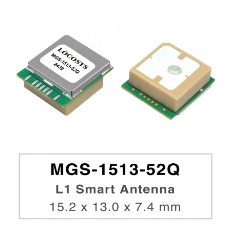
MGS-1513-52Q
MGS-1513-52Q
MGS-1513-52Q is a complete standalone multi-frequency GNSS smart antenna module, including embedded patch antenna and GNSS receiver circuits which is based Airoha AG3352Q platform. The module can simultaneously acquire and track multiple satellite constellations that include GPS, GLONASS, GALILEO, BAIDOU, and QZSS simultaneously, which in combination with the support of SBAS, greatly increases the number of visible satellites and enhances positioning accuracy. Its superior cold-start sensitivity allows it to acquire, track, and get position fix autonomously in difficult weak signal environment. Its superior tracking sensitivity allows continuous position coverage in nearly all outdoor application environments. The module supports hybrid ephemeris prediction to achieve faster cold start. One is self-generated ephemeris prediction (called EASY) tha is no need of both network assistance and host CPU’s intervention. This is valid for up to 3 days and updates automatically from time to time when GNSS module is powered on and satellites are available. The other is server-generated ephemeris prediction (called EPO) that gets from an internet server. This is valid for up to 14 days. Both ephemeris predictions are stored in the on-board flash memory and perform a cold start time less than 15 seconds. The faster GNSS fixes make it possible to use accurate positioning and navigation services anytime and anywhere with a smaller power budget than previously possible. Available in a cost-optimized version as well as a low-power version which supports for the Adaptive Low Power (ALP) feature in fitness and normal navigation modes.
-
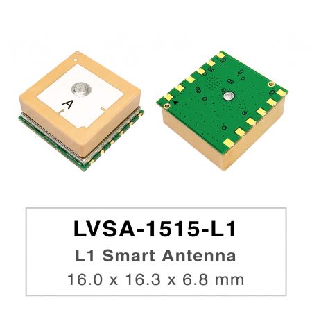
LVSA-1515-L1
LVSA-1515-L1
The LVSA-1515-L1 is a high-performance GNSS smart antenna that integrates a GNSS receiver module with a 15 × 15 × 4 mm ceramic patch antenna in a compact design. It supports single-band, multi-constellation GNSS reception, including GPS, GLONASS, Galileo, BeiDou, QZSS, and SBAS, providing reliable positioning performance for a wide range of navigation applications. Based on an advanced GNSS receiver architecture, the LVSA-1515-L1 delivers excellent positioning accuracy, high sensitivity, and fast signal acquisition. Its robust tracking capability ensures stable positioning performance even in challenging environments such as urban canyons, under dense foliage, or in areas with weak satellite signals. The LVSA-1515-L1 features low power consumption and fast Time-To-First-Fix (TTFF), making it suitable for battery-powered and embedded applications. With continuous multi-constellation tracking and advanced interference mitigation technology, the smart antenna provides reliable positioning performance and enhanced resistance to multipath effects, ensuring dependable operation in demanding outdoor environments. The integrated ceramic patch antenna provides optimized satellite signal reception while maintaining excellent positioning performance. Combined with the built-in low-noise amplifier (LNA) and high-performance GNSS receiver, the LVSA-1515-L1 is an ideal solution for applications such as asset tracking, Location Based Services (LBS), vehicle navigation systems, and Portable Navigation Devices (PNDs).
-
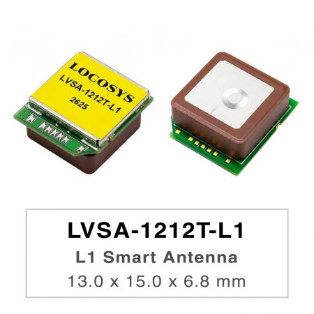
LVSA-1212T-L1
LVSA-1212T-L1
The LVSA-1212T-L1 is a high-performance GNSS smart antenna that integrates a GNSS receiver module with a 12 × 12 × 4 mm ceramic patch antenna in a compact design. It supports single-band, multi-constellation GNSS reception, including GPS, GLONASS, Galileo, BeiDou, QZSS, and SBAS, providing reliable positioning performance for a wide range of navigation applications. Based on an advanced GNSS receiver architecture, the LVSA-1212T-L1 delivers excellent positioning accuracy, high sensitivity, and fast signal acquisition. Its robust tracking capability ensures stable positioning performance even in challenging environments such as urban canyons, under dense foliage, or in areas with weak satellite signals. The LVSA-1212T-L1 features low power consumption and fast Time-To-First-Fix (TTFF), making it suitable for battery-powered and embedded applications. With continuous multi-constellation tracking and advanced interference mitigation technology, the smart antenna provides reliable positioning performance and enhanced resistance to multipath effects, ensuring dependable operation in demanding outdoor environments. The integrated ceramic patch antenna provides optimized satellite signal reception while maintaining excellent positioning performance. Combined with the built-in low-noise amplifier (LNA) and high-performance GNSS receiver, the LVSA-1212T-L1 is an ideal solution for applications such as asset tracking, Location Based Services (LBS), vehicle navigation systems, and Portable Navigation Devices (PNDs).
-
-52Q-1.jpg?v=2ad50c11)
LC20032(M)-52Q
LC20032(M)-52Q
LC20032(M)-52Q is based on the proven technology found in LOCOSYS 47 channel GNSS SMD type receiver MG-1612-52Q that uses Airoha chip solution, designed for a broad spectrum of OEM system applications. This module providing fast time-to-first-fix, one-second navigation update and low power consumption. It can provide you with superior sensitivity and performance even in urban canyon and dense foliage environment. Its far-reaching capability meets the sensitivity requirements of car navigation as well as other location-based applications. This module supports hybrid ephemeris prediction to achieve faster cold start. One is self-generated ephemeris prediction that is no need of both network assistance and host CPU’s intervention. This is valid for up to 3 days and updates automatically from time to time when GNSS module is powered on and satellites are available. The other is server-generated ephemeris prediction that gets from an internet server. This is valid for up to 14 days. Both ephemeris predictions are stored in the on-board flash memory and perform a faster cold start time.
Press Release
-
 Taiwan Excellence Drone Alliance Visits LOCOSYS Technology, Focusing On Global Positioning Technology And Drone Applications
The Taiwan Excellence Drone Overseas Business Alliance, led by Yen Tung-Piao,visited a leading smart manufacturing enterprise with a delegation includingrepresentatives from AIDC, the Industrial...
Read More -
 LOCOSYS Showcases Advanced Smart Positioning Technology At New Taipei Electric Vehicle Supply Chain Expo
To promote the development of Taiwan's electric vehicle (EV) industry and enhance international collaboration, the New Taipei City Government hosted the Electric Vehicle Supply Chain Expo...
Read More -
 LOCOSYS Technology Unveils New High-Performance SONY GNSS/RTK Global Satellite Positioning Modules
LOCOSYS will showcase its advanced RTK solutions and high-performance GNSS modules, including those powered by Sony’s latest GPS technology, at the 2024 Sensor Expo in Tokyo. These modules,...
Read More