Hawk-L2e (U15 + e-compass)
HAWK-L2e is a high-performance dual-frequency GNSS receiver specifically designed for Pixhawk (PX4)-based UAV platforms and next-generation autonomous navigation applications. Engineered with advanced L1 + L5 multi-constellation GNSS technology, HAWK-L2e concurrently tracks all major global navigation satellite systems, including GPS, GLONASS, Galileo, BeiDou, QZSS and SBAS, significantly improving positioning accuracy, satellite availability and signal robustness across diverse operating environments.
By combining dual-frequency signal processing with multi-constellation tracking, HAWK-L2e delivers sub-meter positioning accuracy while enhancing navigation stability in dense urban areas, open skies and electromagnetically challenging conditions. Leveraging advanced satellite signal processing algorithms and intelligent multi-frequency positioning techniques, the receiver achieves superior solution reliability and rapid convergence even under weak-signal or partially obstructed scenarios, making it an ideal solution for UAV navigation, aerial inspection, aerial imaging, swarm flight control and smart logistics applications.
At the core of HAWK-L2e is a highly integrated GNSS receiver chipset and positioning engine built on an advanced RF and baseband integration architecture. Featuring a Cortex-M4F processing core operating at 350 MHz and fabricated using 22-nm technology, the receiver delivers exceptional computational capability while maintaining excellent power efficiency. Through advanced signal acquisition strategies and intelligent positioning algorithms, HAWK-L2e can rapidly evaluate massive time-frequency search spaces, substantially improving satellite acquisition sensitivity and reducing Time-To-First-Fix (TTFF). Its outstanding cold-start performance and tracking sensitivity allow fast and stable positioning even in challenging signal environments.
The built-in lightweight helical antenna further enhances GNSS positioning stability while helping reduce overall UAV payload weight and power consumption, contributing to extended drone flight time. Combined with fast GNSS convergence, low power operation and robust tracking sensitivity, HAWK-L2e provides an optimized navigation solution for Pixhawk (PX4)-based UAV systems requiring reliable and high-precision positioning performance.
Designed as a highly integrated GNSS module, HAWK-L2e incorporates optimized RF circuitry, baseband processing, filtering, amplification stages, positioning algorithms and system interfaces within a compact architecture. This integration eliminates the need for complex RF tuning and GNSS signal optimization at the system level, enabling developers to simplify hardware design, shorten integration cycles and accelerate product deployment while reducing development risks and overall time-to-market.
For UAV and other high-reliability navigation applications, HAWK-L2e also incorporates enhanced anti-jamming and anti-spoofing capabilities. The receiver provides satellite signal quality indicators and interference monitoring information through its output messages, allowing host systems to detect positioning degradation caused by external interference or spoofing attempts. This capability enables real-time mitigation strategies such as switching navigation modes or activating safety mechanisms, significantly improving operational reliability and flight safety.
With its combination of high-precision dual-frequency positioning, superior signal robustness, lightweight integrated antenna design, low power consumption and simplified system integration, HAWK-L2e is ideally suited for UAV navigation, autonomous aerial systems, IoT tracking devices and emerging intelligent mobility applications requiring stable and efficient GNSS performance.
To ensure long-term reliability and manufacturing consistency, the product is developed and manufactured under the internationally recognized IATF 16949 automotive quality management framework. This rigorous quality system encompasses comprehensive design verification, manufacturing process control, supply chain management and continuous improvement practices, ensuring outstanding product stability, traceability and operational reliability for industrial and UAV navigation markets.
FEATURES
GNSS Performance
• Supports reception of five major global satellite systems, including GPS, GLONASS, Galileo, BeiDou, QZSS, and SBAS.
• Capable of simultaneous L1 + L5 dual-frequency reception.
• Number of tracking channels: 200 channels.
• Ultra-high tracking sensitivity: -165 dBm.
• Update frequency: 10Hz (default) up to 20Hz.
• High-speed signal search engine for accelerated positioning startup.
• Multipath detection and suppression for improved positioning stability.
• High-speed signal search engine for rapid satellite acquisition during cold starts.
• Fast satellite acquisition with short TTFF (Time To First) acquisition time.
• Supports power-saving and ultra-low power consumption settings.
• GNSS positioning accuracy 1m.
• Adaptively adjusts received signals based on current environmental satellite signals to quickly ptimize performance.
• It features AI-driven anti-interference and anti-spoofing capabilities, and can display output nformation such as warnings, alerts, and termination.
Hardware & Integration
| Category | Specification |
|---|---|
| RF Front-End | Integrated RF front-end with built-in LNA and SAW filter |
| Output Protocol | Standard NMEA-0183 output, with optional proprietary protocol |
| Wide operating voltage | 3.3 V – 5.0 V |
| Low power consumption | ≤ 42 mA @ 3.3 V |
| Dimensions | 57 × 52 × 17 mm |
| Wire specifications | L: 400 mm |
Quality & Reliability
• Industrial temperature range: −
• AEC-Q100 qualified GNSS chipset (Option).
• Manufactured under IATF 16949 quality system.
• RoHS compliant (lead-free).
APPLICATIONS
• UAV / Drone Navigation
• Autonomous Ground Vehicles (AGV / UGV)
LV-1612-U15 RTL Performance:Practical Implementation and Testing

Press Release
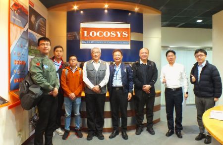
Taiwan Excellence Drone Alliance Visits LOCOSYS Technology, Focusing On Global Positioning Technology And Drone ApplicationsThe Taiwan Excellence Drone Overseas Business Alliance, led by Yen Tung-Piao,visited a leading smart manufacturing enterprise with a delegation includingrepresentatives from AIDC, the Industrial...
Read More
LOCOSYS Showcases Advanced Smart Positioning Technology At New Taipei Electric Vehicle Supply Chain ExpoTo promote the development of Taiwan's electric vehicle (EV) industry and enhance international collaboration, the New Taipei City Government hosted the Electric Vehicle Supply Chain Expo...
Read More
LOCOSYS Technology Unveils New High-Performance SONY GNSS/RTK Global Satellite Positioning ModulesLOCOSYS will showcase its advanced RTK solutions and high-performance GNSS modules, including those powered by Sony’s latest GPS technology, at the 2024 Sensor Expo in Tokyo. These modules,...
Read More