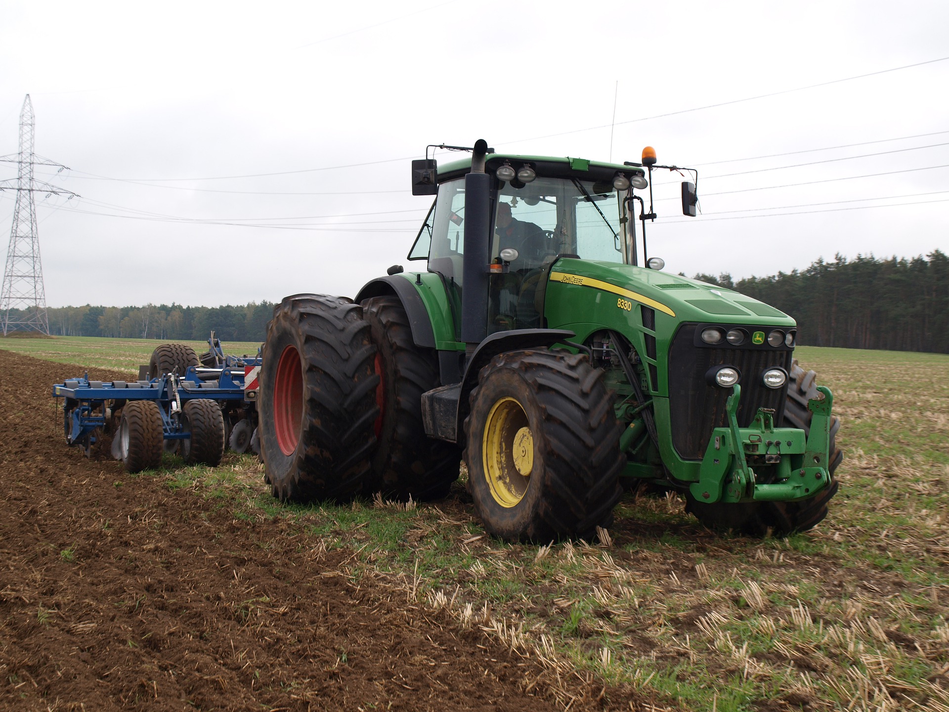
Agriculture

agriculture with gps
Precision Agriculture (or Site-specific Farming) is planned for the rising of the productivity. It saves the time and the cost of maintenance from traditional farming. GPS technology plays an especially crucial role in making this happen. GPS-based applications in precision farming are being used for farm planning, field mapping, soil sampling, tractor guidance, crop scouting, variable rate applications, and yield mapping, and so on. Therefore, RTK products are highly recommended for these Precision Farming businesses.
Agriculture Smart Machinery
An Agricultural Smart Machinery is using the technology of combining wireless remote monitoring and multi-constellation positioning(GNSS), it reduces the time and the cost of maintenance from traditional farming. Intelligence monitoring and in-time report allow the farmers and workers to spend their valuable time without worrying about the machines.
Smart monitoring and control
Even more, traceable data is constantly sending to your secured cloud, you are now able to monitor effectively and control the production capabilities by easy-to-use software and reliable telemetry based station.
Cost efficiency and energy friendly
LOCOSYS combo module is capable of intelligently connection and free data transmission, with Bluetooth Low Energy, you can even make a free connection to any device you truly wanted at any time without concerning heavy power drains, lowering the cost of any data transmission, makes life better and simpler.
LOCOSYS GPS Agriculture real case
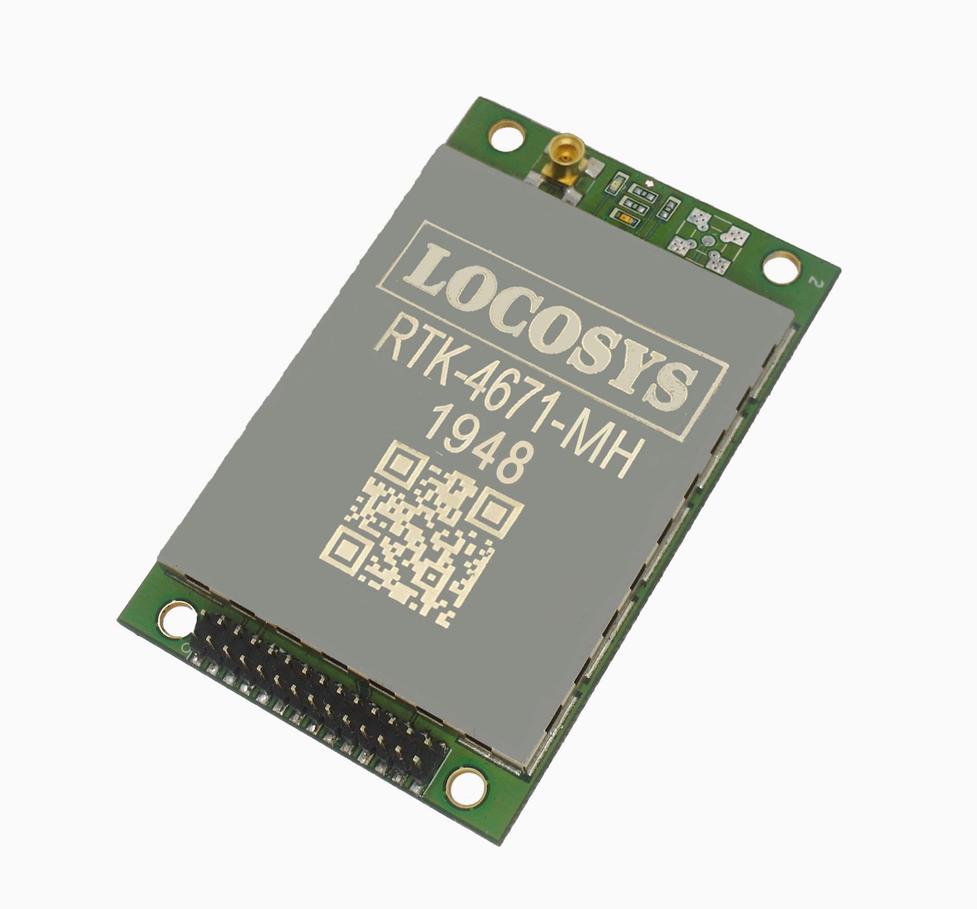 |
The dual-frequency RTK-4671-MH receiver is a compact, cost-effective and high-precision GNSS RTK board designed for applications requiring centimeter level positioning accuracy. It supports multiple constellations, including GPS, GLONASS, BeiDou, GALILEO, QZSS and SBAS to improve the continuity and reliability of RTK solution even in the harsh environment. |
LOCOSYS RTK-4671-MHPD is a dual-frequency, dual-antenna receiver targeting for precision agriculture, drones, and slow-moving vehicles. | 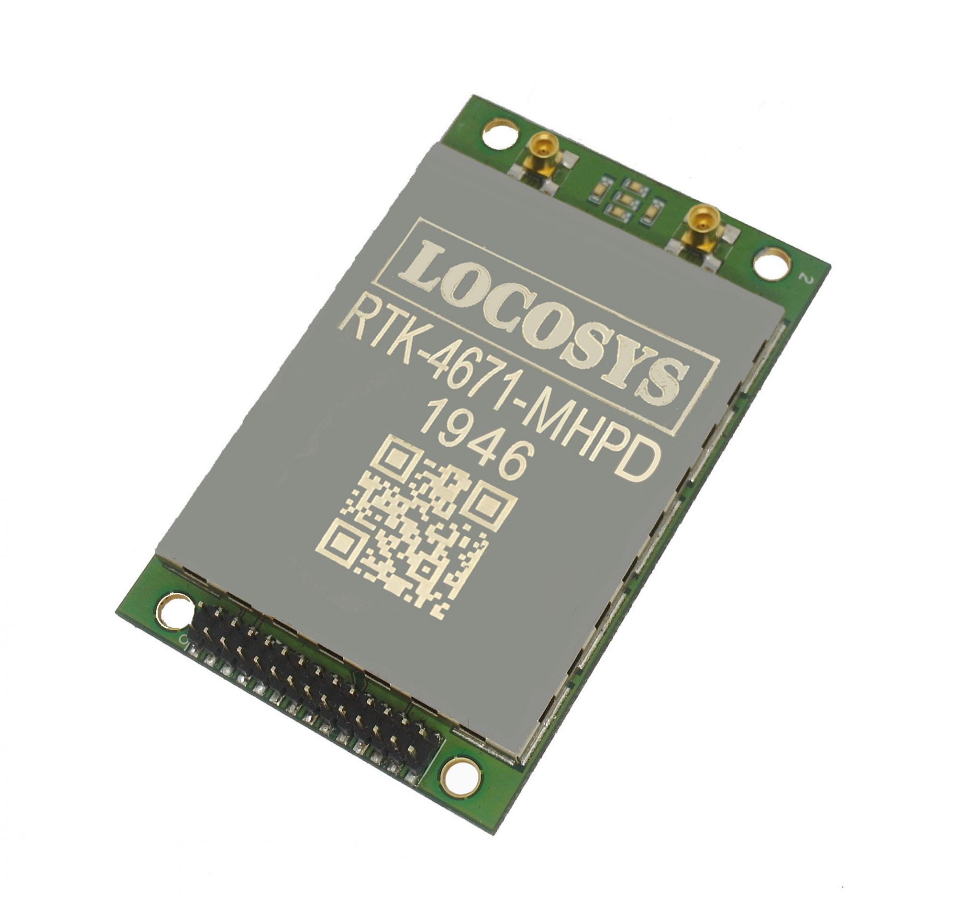 |
- Related Products
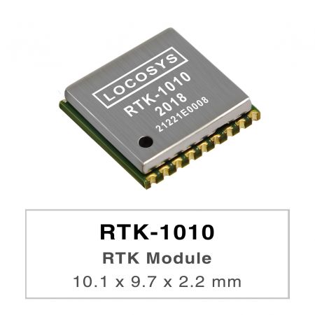
RTK-1010
RTK-1010
RTK-1010 是一款高性能双频GNSS RTK 模组,专为需要公分级定位精度的应用而设计。它采用12nm 制程并集成高效的电源管理架构,实现低功耗和高灵敏度。 该模组支持GPS、GLONASS、北斗、GALILEO 和QZSS 的同时接收,能够提高RTK 解决方案的可用性和可靠性,即使在严苛的环境中也能稳定工作。

RTK Board (L1+L2)
RTK-4671-MH
The dual-frequency RTK-4671-MH receiver is a compact, cost-effective and high-precision GNSS RTK board designed for applications requiring centimeter level positioning accuracy. It supports multiple constellations, including GPS, GLONASS, BeiDou, GALILEO, QZSS and SBAS to improve the continuity and reliability of RTK solution even in the harsh environment. This board can be setup either in rover mode or in base station mode. Versatile, compact, smart, low power and high update rate, LOCOSYS RTK-4671-MH meets the requirement of most location-based applications.

RTK Board (L1+L2)
RTK-4671-MHPD
LOCOSYS RTK-4671-MHPD is a dual-frequency, dual-antenna receiver targeting for precision agriculture, drones, and slow-moving vehicles. This receiver provides fast precise heading and RTK position. It supports multiple constellations, including GPS, GLONASS, BeiDou, GALILEO, QZSS and SBAS to improve the continuity and reliability of precise heading and RTK position even in the harsh environment. Besides, it features powerful compatibility with other GNSS receivers in the market by flexible interfaces, smart hardware design and popular log/command formats. Versatile, compact, smart, low power and high update rate, LOCOSYS RTK-4671-MHPD meets the requirement of most location-based applications.


RTK 系统盒
RTK-M200
The RTK-M200 is the category solution in the LOCOSYS RTK (Real Time Kinematics) product family. The RTK-M200 act as a reference station in a RTK setup. The system combine the centimeter level RTM dual band (L1+L5) GNSS module and 4G LTE modem module. A Mobile RTK correction signal is transmitted via cellular network. This provides repeatable accuracy even in hilly terrain or in scattered fields.
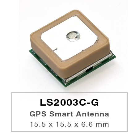
LS2003C-G 独立GNSS 含天线模组
LS2003C-G
LS2003C-G是一个完整的独立GNSS天线模组,包括嵌入式贴片天线和GNSS接收器电路。该模组可同时采集和跟踪多颗卫星包括GPS,GLONASS,GALILEO,QZSS和SBAS的星座。它具有低功耗和小尺寸。此外,即使在城市峡谷和茂密的树叶环境中,它也能为您提供卓越的灵敏度和性能。 该模组支援混合星历预测,实现更快的冷启动。一个是自生产的星历预测(称为EASY),不需要网络协助和主机CPU的干预。这最多可以持续3天,GNSS模组上电时会自动更新卫星可用。另一个是服务器生成的星历预测(称为EPO)互联网服务器最多14天有效。这两个星历预测都存储在板载闪存中记忆并执行冷启动时间少于15秒。 无需在分离的GNSS中需要的RF连接器和同轴电缆即可轻松安装有源天线。换句话说,降低成本和大小。另外,通过消除加快上市时间分离GNSS天线和模组之间的RF匹配和稳定性的研发工作。此外,它可以直接由锂电池供电,无需任何外部电压常规。因此,LS2003C-G的微型尺寸和辉煌的性能是融入您的超薄设备的最佳选择。

LS2003C-2RE 独立GPS 含天线模组
LS2003C-2RE
LS2003C-2RE是一个完整的独立GPS天线模组,包括嵌入式贴片天线和GPS接收器电路。该模组由联发科GPS最新的MT3337E芯片提供支援一次获取大量卫星,同时提供快速的第一时间固定和低功耗。此外,即使在都市峡谷和茂密的树叶环境中,它也能为您提供卓越的灵敏度和性能。该模组支援自我生成轨道预测,EASYTM,实现更快的冷启动和热启动。 EASYTM不需要网络协助和主机CPU的干预。该预测有效期最长为3天,GPS模组上电且卫星可用时,会自动更新。无需在分离的GPS有源天线中需要的RF连接器和同轴电缆即可轻松安装。换句话说,降低成本和大小。 另外,通过消除分离GPS天线和模组之间的射频匹配和稳定性的研发工作,加快上市时间。此外,它可以直接由锂电池供电,无需任何外部稳压器。因此,LS2003C-2RE的微型尺寸和辉煌的性能是将其整合到您的超薄设备中的最佳选择。
新闻稿
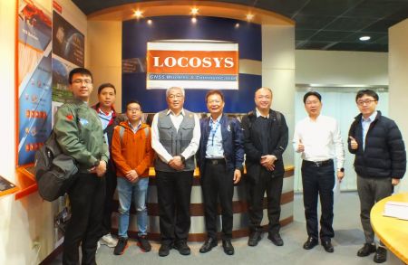 台湾卓越无人机联盟参访大辰科技领先企业 聚焦全球定位技术与无人机应用
台北时间上午10点,台湾卓越无人机海外商机联盟在颜东标的带领下,由汉翔航空工业、工业技术研究院及经济部航太产业推动小组等产业代表组成参访团,莅临智慧制造领域的领先企业进行技术交流。本次参访中,Locosys大辰科技分享了在RTK(即时动态定位)、惯性导航技术,以及天线应用于无人机系统上的最新成果,并特别介绍了飞行路径自主规划演算法等技术亮点。此外,生产品质管理系统的导入及其助力智慧制造的成功经验,也成为交流重点之一。
阅读更多 LOCOSYS大辰科技参加新北电动车产业链博览会展现领先智慧定位技术
为推动台湾电动车产业发展并促进国际交流,新北市政府举办「电动车产业链博览会」,盛大汇聚国内外知名企业与创新新创公司共同参与。作为全球定位技术的领导者,LOCOSYS大辰科技在本次展会中亮相,展示其最新的高精度定位技术,致力于推动电动车产业迈向智慧化与永续发展。新北市市长侯友宜莅临LOCOSYS大辰科技摊位,对其创新技术给予高度肯定。
阅读更多 LOCOSYS大辰科技推出全新高性能SONY (GNSS/RTK) 全球卫星定位模组
LOCOSYS大辰科技欣然宣布推出三款全新高性能GNSS/RTK 卫星定位模组,包括SO-1612-15、SO-1612-1N 和SOR-1612。模组采用日本知名晶片大厂SONY 的最新CXD...
阅读更多