搜寻lawn mower|大辰科技

大辰科技有限公司成立于2005年,我们提供全球导航卫星系统(GNSS),无线通信,嵌入式系统,航空电子,汽车和消 费<br /> 电子等硬体和软体的服务范围。

结果 1 - 16 的 16
  • GNSS-DUAL
    GNSS-DUAL
    GNSS-DUAL

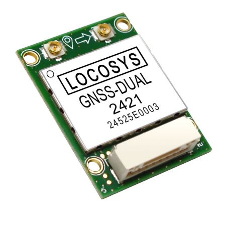
    GNSS-DUAL is a dual-frequency GNSS compass module that designed for applications requiring accurate dual-antenna GNSS-based heading. The dual-antenna GNSS-based heading is not subject to magnetic interference. Unlike a standard GNSS module that can only estimate heading based on the movement, GNSS-DUAL provides an accurate heading even while the vehicle is stationary. It is capable of concurrently tracking all global civil navigation systems, including GPS, GLONASS, GALILEO, BEIDOU and QZSS. It acquires both L1 and L5 signals at a time while providing accurate heading between dual antennas. GNSS-DUAL adopts 12nm process and integrates efficient power management architecture to become one of the leading groups with the lightest weight and lowest power consumption on the market.


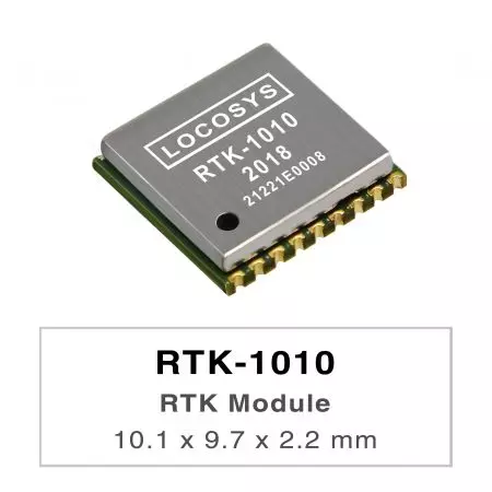
  • RTK-1010
    RTK-1010
    RTK-1010

    The RTK-1010 is a high-performance dual-band GNSS RTK module that designed for applications requiring centimeter level positioning accuracy. It adopts 12 nm process and integrate efficient power management architecture to perform low power and high sensitivity. The module supports concurrent reception of GPS, GLONASS, BeiDou, GALILEO, and QZSS to improve the availability and reliability of RTK solution even in the harsh environment.


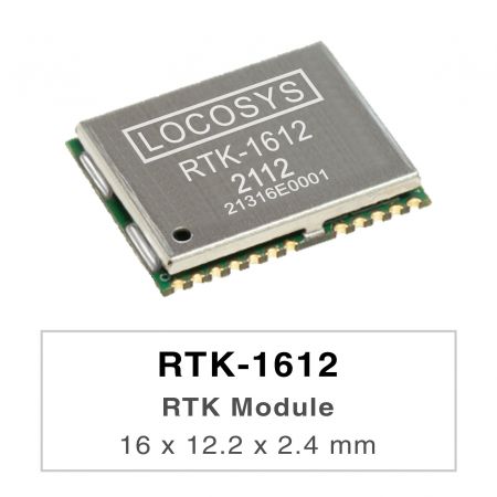
  • RTK-1612
    RTK-1612
    RTK-1612

    The RTK-1612 is a high-performance dual-band GNSS RTK module that designed for applications requiring centimeter level positioning accuracy. It adopts 12 nm process and integrate efficient power management architecture to perform low power and high sensitivity. The module supports concurrent reception of GPS, GLONASS, BeiDou, GALILEO, and QZSS to improve the availability and reliability of RTK solution even in the harsh environment.


  • RTK+DR Modules
    RTK+DR Modules
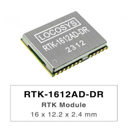
    RTK-1612AD-DR

    LOCOSYS RTK-1612AD-DR uses an Airoha AG3335AD chip, dual-frequency multi-constellation solution GNSS, providing RTK high precision and sensor fusion solution in one. It not only supports GPS, GLONASS, GALILEO, BEIDOU, and QZSS but also has inertial sensors (3-axis accelerometers and 3-axis gyros) to provide an untethered dead reckoning function. In addition to DR, an inertial sensor can detect the vehicular dynamics when it is attached firmly on the vehicle. Consequently, abnormal driving behaviors and the vehicle status can be detected and the alarm status will be enabled to remind the users. No requirement of installation orientation and automatic calibration function make it easy to use. With these features, RTK-1612AD-DR can reduce position errors in multipath environment and continue to work where GNSS signals are poor or not available, such as tunnels and indoor parking lots, as well as deliver seamless navigation.


  • RTK-1612AB-DR
    RTK-1612AB-DR
    RTK-1612AB-DR

  • BKR-1612
    BKR-1612
    BKR-1612

    The BKR-1612 is a receiving module that supports Dual-Band & Multi-Mode. It has built-in highly integrated GNSS receiver chip, supports multi band and multi system cm4f (main frequency 350Mhz, 22nm Technology) chip of Third-generation BEIDOU Navigation Satellite System (BDS-3). Besides, it is capable of tracking all global civil navigation systems (GPS, GLONASS, GALILEO, BEIDOU, QZSS, IRNSS and SBAS) in all bands.   BKR-1612 module is based on the state of art BDS-3 architecture, integrating multi-band and multi-system GNSS RF and baseband. This newly designed architecture makes this single chip achieve sub-meter level positioning accuracy without correction data from ground- based augmentation station and higher sensitivity, greater for improved jam resistance and multipath, provide a highly robust service in complicated environment.   BKR-1612 module contains positioning engine inside, featuring high sensitivity, low power consumption, and fast TTFF. The superior cold start sensitivity allows it to acquire, track, and get position fix autonomously in difficult weak signal environment. The receiver's superior tracking sensitivity allows continuous position coverage in nearly all outdoor application environments. The high-performance signal parameter searching engine is capable of testing 16 million time-frequency hypotheses per second, offering superior signal acquisition and TTFF speed.


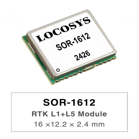
  • SOR-1612
    SOR-1612
    SOR-1612

  • LS23231
    LS23231
    LS23231

    LS23231 is a dual-frequency GNSS RTK receiver designed for Pixhawk2-based drone. The receiver is capable of concurrently tracking all global civil navigation systems, including GPS, GLONASS, GALILEO, BEIDOU and QZSS. It acquires both L1 and L5 signals at a time while providing the centimeter-level RTK positioning accuracy. The built-in lightweight helical antenna not only enhances RTK positioning stability, but also increases the flight time of the drone. The fast Time-To-First-Fix, RTK convergence, superior sensitivity, low power consumption and water proof make it a better choice for Pixhawk2-based drone.


  • LS23236
    LS23236
    LS23236

    LS23236 is a dual-frequency multi-constellation GNSS receiver providing RTK high precision and sensor fusion solution. It not only supports GPS, GLONASS, GALILEO, BEIDOU and QZSS, but also has inertial sensors (3-axis accelerometers and 3-axis gyros) to provide dead reckoning.   No requirement of installation orientation and automatic alignment function make it easy to use. With these features, LS23236 can reduce position errors in multipath environment and continue to work where GNSS signals are poor or not available, such as tunnels and indoor parking lots, as well as deliver seamless navigation. The fast Time-To-First-Fix, RTK convergence, superior sensitivity, low power consumption and water proof make it a better choice for car navigation.


  • RTK board (L1+L5)
    RTK board (L1+L5)
    RTK-4057-MHPD

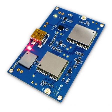
    LOCOSYS RTK-4057-MHPD is a L1+L5 Dual-Frequency Position with Heading RTK Board, which targeting for precision autonomous guided vehicle, smart agriculture, unmanned aerial vehicle, and any other unmanned system to integrate in.   This receiver board provides fast precise heading and RTK position. It supports global multiple constellations, including GPS, GLONASS, BeiDou, GALILEO, QZSS and SBAS to improve the continuity and reliability of precise heading and RTK position even in the harsh environment.   Besides, it features powerful compatibility with other GNSS receivers in the market by flexible USB interfaces, smart hardware design and output standard NMEA formats. Versatile, compact size, complete driver support, low power and high update rate.   LOCOSYS RTK-4057-MHPD meets Windows, Linux, Raspberry Pi and Nvidia developer requirements or system integrator need, and helps you quickly realize unmanned application positioning function.


  • RTK board (L1+L5)
    RTK board (L1+L5)
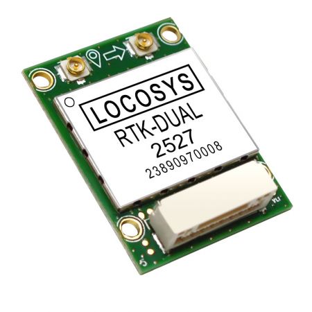
    RTK-DUAL

    RTK-DUAL series is a dual-frequency multi-constellation RTK module that designed for applications requiring accurate dual-antenna GNSS-based heading and RTK centimeter level positioning accuracy. The dual-antenna GNSS-based heading is not subject to magnetic interference. Unlike a standard dual-frequency multi-constellation RTK Module that can only estimate heading based on the movement, RTK-DUAL provides an accurate heading even while the vehicle is stationary. It is capable of concurrently tracking all global civil navigation systems, including GPS, GLONASS , GALILEO, BEIDOU and QZSS. It acquires both L1 and L5 signals at a time while providing heading between dual antennas and RTK position. RTK-DUAL adopts 12nm process and integrates efficient power management architecture to become one of the leading groups with the lightest weight and lowest power consumption on the market. Paired with our dual-frequency low power helical antennas, it can extend the usage time of battery powered drones, robotic lawn mowers, automated logistics vehicles, etc.


  • LH-1256AR-D / LH-1256AR-E / LH-1256L / LF-1256L
    LH-1256AR-D / LH-1256AR-E / LH-1256L / LF-1256L
    LH-1256AR-D / LH-1256AR-E / LH-1256L / LF-1256L

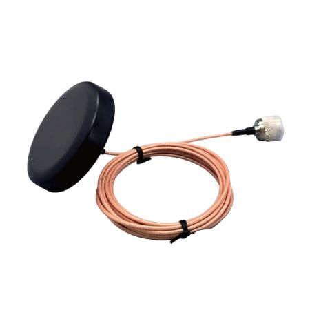
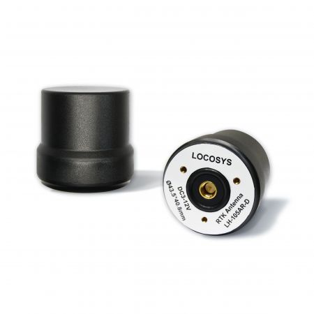
    LH-1256AR-D is an four constellations multi-band GNSS helix antenna for L1 ,L2 ,L5 and L-bands of GPS/QZSS, GLONASS, GALILEO, BEIDOU and IRNSS. This antenna's small size, light weight, and low power consumption make it ideal for applications requiring RTK-level positioning accuracy, such as autonomous vehicles, drone displays, aerial photography, high-precision mapping, remote sensing, traffic control, and public safety.   The LH-1256AR-E is a compact and lightweight four-constellation multi-band GNSS helix antenna, supporting L1, L2, L5, and L-bands of GPS/QZSS, GLONASS, GALILEO, BEIDOU systems. This antenna is designed to deliver reliable and accurate GNSS reception across multiple satellite systems, making it versatile for diverse operational needs in challenging environments.   LH-1256L is an active GNSS antenna for all bands of GPS/QZSS, GLONASS, GALILEO, BEIDOU and NAVIC. It also supports L band from 1525MHz to 1559MHZ. The antenna is light and low power consumption that is ideal for applications requiring RTK level positioning accuracy, such as self-driving vehicle,UAV, aerial photography, high precision mapping, remote sensing, traffic control and public security.   LOCOSYS LF-1256L embedded antenna is designed for high precision positioning and offers superior satellite signal tracking, including GPS, GLONASS, GALILEO, and Beidou, as well as L-Band correction service. It supports multiple frequency bands, including L1, L2, and L5, enhancing its capability to receive more accurate and reliable signals from different constellations. The antenna is equipped with an SMA connector, allowing for easy integration with various devices and systems. Its RTK level positioning accuracy makes it ideal for applications such as surveying, mapping , hand-held device, and various UAV operations, where precision and reliability are critical. The multi-frequency support and SMA interface ensure stable connections, mitigating issues like signal interference and multipath errors, ensuring robust performance in challenging environments.


  • LH-105A2-B / LH-105AR-D / LH-105AR-DC / LF-105A2-B
    LH-105A2-B / LH-105AR-D / LH-105AR-DC / LF-105A2-B
    LH-105A2-B / LH-105AR-D / LH-105AR-DC / LF-105A2-B

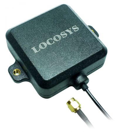
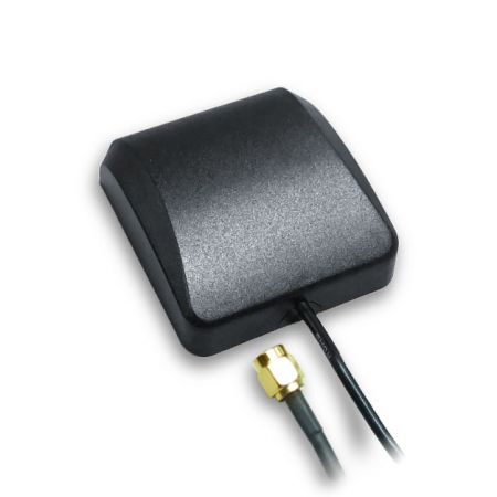
    LH-105A2-B and LH-105AR-D and LH-105AR-DC are active dual-frequency GNSS antenna for L1 and L5 bands of GPS/QZSS, GLONASS, GALILEO , BEIDOU and IRNSS. The antenna is light and low power consumption that is ideal for applications requiring RTK level positioning accuracy, such as self-driving vehicle, drone display, aerial photography, high precision mapping, remote sensing, traffic control and public security.   LOCOSYS LF-105A2-B embedded antenna is designed for high precision positioning and offers superior satellite signal tracking, including GPS, GLONASS, GALILEO, and Beidou service. It supports multiple frequency bands, including L1 and L5, enhancing its capability to receive more accurate and reliable signals from different constellations. The antenna is equipped with an SMA connector, allowing for easy integration with various devices and systems. Its RTK level positioning accuracy makes it ideal for applications such as surveying, mapping, hand-held device, and various UAV operations, where precision and reliability are critical. The multi-frequency support and SMA interface ensure stable connections, mitigating issues like signal interference and multipath errors, ensuring robust performance in challenging environments.


  • Helix 天线
    Helix 天线
    LH-105A2-B

    LH-105A2-B is an active dual-frequency GNSS antenna for L1 and L5 bands of GPS/QZSS, GLONASS, GALILEO, BEIDOU and IRNSS. The antenna is light and low power consumption that is ideal for applications requiring RTK level positioning accuracy, such as self-driving vehicle, drone display, aerial photography, high precision mapping, remote sensing, traffic control and public security.


  • Patch 天线
    Patch 天线
    LP-105AR-C

    The LOCOSYS LP-105AR-C multi-band (GPS L1/L5、GLONASS L1OF、BDS B1/B2a、Galileo E1/E5a、QZSS L1/L5、NavIC) active GNSS/RTK antenna is composed of 50*50*6mm laminated 40*40*4mm ceramic dielectric antenna. The compact design, excellent price-to-performance ratio, and versatile mounting choices provide customers with a fast, easy, and reliable multi-band antenna solution. The LP-105AR-C antenna is a perfect match to LOCOSYS RTK series solutions (for example, RTK-1010、RTK-1612、RTK-M300…), supporting L1 and L5 bands.   The LP-105AR-C includes a high-performance multi-band RHCP dual-resonance, dual-feed patch antenna element, a built-in high-gain LNA with SAW pre-filtering, and a 5-meter antenna cable with an SMA connector.


  • Survey天线
    Survey天线
    LS-125-A/LS-125F-A

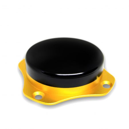
    LS-125-A is a four-star multi-frequency satellite navigation antenna. The antenna has the characteristics of high gain, miniaturization, high sensitivity, multi-system compatibility and high reliability, which can effectively meet the needs of users.   LS-125F-A is a high-precision air-type multi-band measurement antenna that supports the reception of satellite navigation signals from multiple systems such as BDS, GPS, GLONASS, and Galileo. The antenna uses air medium technology and features high gain , good circular polarization performance, high positioning accuracy, and good reception performance at low elevation angles. It can be used in areas such as driver training, unmanned driving base station reference station networking requirements, and high-precision mapping.


结果 1 - 16 的 16

新闻稿