MZ-1722-P GNSS 模組
MZ-1722-P
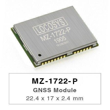
LOCOSYS MZ-1722-P is a multi-constellation dual-frequency GNSS module that can output raw data for high precision location, such as RTK and PPK.
LOCOSYS MZ-1722-P is a multi-constellation dual-frequency GNSS module that can output raw data for high precision location, such as RTK and PPK. The raw measurement and ephemeris data are transmitted with the standard RTCM3.X format that include GPS L1/L2, GLONASS L1/L2, BEIDOU L/L2 and QZSS L1/L2. It also provides autonomous position with NMEA format.The maximum update rate is 10Hz. Besides, built-in anti-jamming technology and rapid requisition make it the good solution for high precision application.
特性
- Support GPS, GLONASS, BEIDOU, and QZSS
- Support dual-frequency raw data
- Built-in anti-jamming technology
- Low signal strength, rapid acquisition
- Industrial operating temperature range -40 to +85°C
- RoHS compliant
- Small form factor 17 x 22.4 x 2.4 mm
- LOCOSYS IATF 16949 certified production sites.
規格
- Satellite System: GPS+GLONASS+ GALILEO + BeiDou + QZSS
- Interface: UART
- Input Voltage: 3.0V - 3.6V
- Power (mA): 115mA
- VB (uA): 66uA
- Operating Temp (°C): -40 ~ 85
- Dimension (mm): 17 x 22.4 x 2.4 mm
應用
- Autonomous Vehicle Guidance
- Autonomous Vehicle (ex: AVN/T-BOX/HUD)
- Internet of Vehicles
- Unmanned Aerial Vehicles
- Precision Agriculture
- Hand-Held Device
- AGV Robotics
- V2V / V2X System
- Geographical measurement
- Geographical survey points
- Offshore / Marine Applications


- 資料下載
-

新聞稿
-
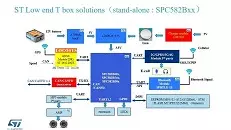 ST 低端车载终端方案
ST 的TBOX 方案是STMicro 汽车电子部门为应对国家对新能源汽车管控的市场需求, 满足GB32960标准提出的车规级的低端车载终端方案。
閱讀更多
该演示和方案由... -
 2018年慕尼黑電子展
2018慕尼黑上海電子展以及電子生產設備展於3月14日至16日舉行,LOCOSYS大辰科技獲STMicro意法半導體邀請參與盛會……
閱讀更多 -
 Dead Reckoning Solutions
LOCOSYS TECHNOLOGY的ST-1612-DGX以其智能慣性導航算法帶來了卓越的定位性能,即使在惡劣的信號環境下,運動傳感器(3D陀螺儀,3D加速度計等)也能保持高精度定位。
閱讀更多