-
ST-1612r-DGX
ST-1612r-DGX
LOCOSYS ST-1612r-DGx dead reckoning (DR) modules are the perfect solution for automotive application. They not only support GPS, GLONASS, GALILEO and QZSS, but also have inertial sensors (3-axis accelerometers and 3-axis gyros) to provide dead reckoning. They will detect if there is an odometer connection or vehicle speed input, and then automatically operate in ADR or UDR mode. Both raw data of the inertial sensors and vehicle’s altitude including pitch, roll and heading angles are outputted for the driver behavior analysis. For example, the internet connected vehicles can automatically send emergency calls (i.e. E-Call) for help based on the vehicle’s altitude. No requirement of installation orientation and automatic calibration function make them easy to use. With these features, ST-1612r-DGx can reduce position errors in multipath environment and continue to work where GNSS signals are poor or not available, such as tunnels and indoor parking lots, as well as deliver seamless car navigation.
-

ST-1612r-DBX
ST-1612r-DBX
LOCOSYS ST-1612r-DBx dead reckoning (DR) modules are the perfect solution for automotive application. They not only support GPS, BEIDOU, GALILEO and QZSS, but also have inertial sensors (3-axis accelerometers and 3-axis gyros) to provide dead reckoning. They will detect if there is an odometer connection or vehicle speed input, and then automatically operate in ADR or UDR mode. Both raw data of the inertial sensors and vehicle’s altitude including pitch, roll and heading angles are outputted for the driver behavior analysis. For example, the internet connected vehicles can automatically send emergency calls (i.e. E-Call) for help based on the vehicle’s altitude. No requirement of installation orientation and automatic calibration function make them easy to use. With these features, ST-1612r-DBx can reduce position errors in multipath environment and continue to work where GNSS signals are poor or not available, such as tunnels and indoor parking lots, as well as deliver seamless car navigation.
-

RTK-1612AD-DR
RTK-1612AD-DR
LOCOSYS RTK-1612AD-DR uses an Airoha AG3335AD chip, dual-frequency multi-constellation solution GNSS, providing RTK high precision and sensor fusion solution in one. It not only supports GPS, GLONASS, GALILEO, BEIDOU, and QZSS but also has inertial sensors (3-axis accelerometers and 3-axis gyros) to provide an untethered dead reckoning function. In addition to DR, an inertial sensor can detect the vehicular dynamics when it is attached firmly on the vehicle. Consequently, abnormal driving behaviors and the vehicle status can be detected and the alarm status will be enabled to remind the users. No requirement of installation orientation and automatic calibration function make it easy to use. With these features, RTK-1612AD-DR can reduce position errors in multipath environment and continue to work where GNSS signals are poor or not available, such as tunnels and indoor parking lots, as well as deliver seamless navigation.
-
-

-

LS23231
LS23231
LS23231 is a dual-frequency GNSS RTK receiver designed for Pixhawk2-based drone. The receiver is capable of concurrently tracking all global civil navigation systems, including GPS, GLONASS, GALILEO, BEIDOU and QZSS. It acquires both L1 and L5 signals at a time while providing the centimeter-level RTK positioning accuracy. The built-in lightweight helical antenna not only enhances RTK positioning stability, but also increases the flight time of the drone. The fast Time-To-First-Fix, RTK convergence, superior sensitivity, low power consumption and water proof make it a better choice for Pixhawk2-based drone.
-

LS23236
LS23236
LS23236 is a dual-frequency multi-constellation GNSS receiver providing RTK high precision and sensor fusion solution. It not only supports GPS, GLONASS, GALILEO, BEIDOU and QZSS, but also has inertial sensors (3-axis accelerometers and 3-axis gyros) to provide dead reckoning. No requirement of installation orientation and automatic alignment function make it easy to use. With these features, LS23236 can reduce position errors in multipath environment and continue to work where GNSS signals are poor or not available, such as tunnels and indoor parking lots, as well as deliver seamless navigation. The fast Time-To-First-Fix, RTK convergence, superior sensitivity, low power consumption and water proof make it a better choice for car navigation.
Press Release
-
 GPS rollover issue
Dear valued customers/partners,
Read More
Please reach your sales person, distributing partners or email to info@locosystech.com for further info.
if you have any GPS rollover question/issue to LOCOSYS'... -
 2019 Electronica
2019 Electronica China was held at the Shanghai New International Expo Center on March 20-22, 2019.
Read More -
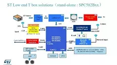 ST low-end vehicle terminal solution
ST's T-BOX solution is a vehicle terminal solution designed by STMicro's automotive electronics division in order to meet the national requirement for new energy vehicle control and to meet...
Read More